WHAS Weather Forecast Accuracy Scoreboard
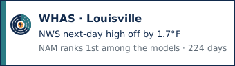
At Louisville Muhammad Ali International Airport (KSDF), the National Weather Service next-day high has been off by 1.7°F on average over 224 days. NAM has the smallest miss on highs among the models, off by 1.8°F on average over 216 days.
Louisville weather forecast accuracy
WHAS is a television station in Louisville. Forecast Scoreboard does not grade television stations. The numbers below are the National Weather Service and the models at Louisville Muhammad Ali International Airport (KSDF).
National Weather Service at Louisville Muhammad Ali International Airport
Next-day forecast at KSDF, the market airport. The airport is in the NWS Louisville office (NWS LMK).
| LeadHow far ahead. Day 1 is the next calendar day. Days 6 and 7 are shown and are not in the headline score. The technical name is lead. | Matched daysDays scored. How many climate days this number is averaged over. The technical name is matched days. | High MAEAverage miss on daily highs, in degrees F. Mean absolute error. Lower is better. | High biasAverage of the signed misses on daily highs, in degrees F. Positive means the forecast was too warm. The technical name is high bias. | Low MAEAverage miss on daily lows, in degrees F. Lower is better. The low is the climate-day minimum, which is not always the overnight low. | Low biasAverage of the signed misses on daily lows, in degrees F. Positive means the forecast was too warm. The technical name is low bias. | Brier scoreRain probability score. Average of (forecast probability minus what happened) squared. Lower is better. The technical name is the Brier score. |
|---|---|---|---|---|---|---|
| Day 1 | 224 | 1.7° | 0.1° | 3.5° | 0.2° | 0.112 |
| Day 2 | 223 | 2.0° | 0.1° | 3.4° | 0.4° | 0.110 |
| Day 3 | 222 | 2.5° | 0.1° | 3.2° | 0.2° | 0.115 |
| Day 4 | 221 | 2.9° | 0.4° | 3.1° | 0.3° | 0.142 |
| Day 5 | 220 | 3.3° | 0.4° | 3.3° | 0.3° | 0.161 |
| Day 6 extended | 219 | 4.0° | 0.3° | 4.1° | -0.4° | 0.173 |
| Day 7 extended | 38 | 5.6° | -1.4° | — | — | 0.128 |
Bias is forecast minus observed. Positive means the forecast was too warm. These are the same National Weather Service numbers as the market page.
Top models at KSDF
Same airport, same next-day scores as the market page.
| Place on this list. 1 was closest to the weather that happened. A tie shares this number, and the next place skips ahead. Early read until the longer day count, then proven. | The weather model. Models are scored on their own against the National Weather Service. | SkillBeats the National Weather Service when the miss is smaller on the same days. 0 is the same, positive is better, negative is worse. The technical name is skill: 1 minus this forecast's loss divided by the Weather Service loss. | High errorAverage miss on daily highs, in degrees F. Lower is better. | Matched daysDays scored. How many climate days this number is averaged over. The technical name is matched days. | StatusEarly read means at least 90 days scored. Proven means 180 or more. Still collecting means it is too soon to rank. The technical names are provisional and established. |
|---|---|---|---|---|---|
| 1 | NAM | Behind the NWS by 6% | 216 | Proven | |
| 2 | HRRR | Behind the NWS by 8% | 223 | Proven | |
| 3 | ECMWF IFS | Behind the NWS by 32% | 223 | Proven | |
| 4 | GFS | Behind the NWS by 37% | 224 | Proven | |
| 5 | ECMWF AIFS | Behind the NWS by 43% | 223 | Proven |
The bar is the mean high-temperature error. A shorter bar is closer to the observed high. Skill above zero beats the National Weather Service on the same days.
National Weather Service office: NWS Louisville forecast accuracy (NWS LMK).
Weather models scored against the National Weather Service.
A meteorologist is scored only after they opt in, on public forecasts they post or share. A name on a staff page is not a score.
Other stations in Louisville
Embed this badge
Next-day highs at Louisville Muhammad Ali International Airport (KSDF). The day count is the scored days on file. A rank starts at 90 days.